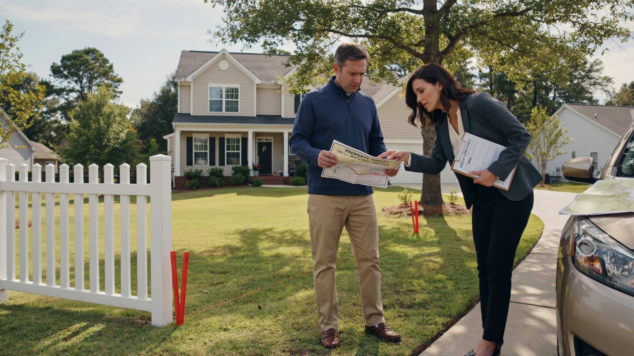
When Buyers tour a home, they often look across the backyard and assume everything inside the fence belongs to the property. Sometimes that assumption is correct. Sometimes it is not. Fences, landscaping, driveways, retaining walls, online parcel maps, recorded plats, surveys, easements, and legal property boundaries are different pieces of information. If the land itself matters to your purchase, understand which piece of evidence you are actually relying on before closing.
What Should Buyers Know About a Home’s Property Boundaries?
Before assuming where the yard begins and ends, understand the difference between what you can see and what the property records and survey evidence actually show.
Prefer to Watch?
Property Boundaries: What Buyers Should Check
Watch the video, then use the checklist below when evaluating a property.
A Fence Shows
Where Someone
Built a Fence.
It Does Not Automatically Prove
Where the
Legal Property Line Is.
Use the Boundary Certainty Test
When a property's boundaries matter to your buying decision, work through five different layers:
Record Description
+
Recorded Plat / Survey Evidence
+
Physical Occupation
+
Easements / Rights-of-Way
+
Your Intended Use
−
Unresolved Boundary Conflict
=
Boundary Certainty
Before Saying “That Is My Property Line,” Ask:
“What Am I Relying On to Know That?”
1. Start With the Legal Property—not the Visible Yard
When you purchase real estate, you are not simply purchasing:
“everything that looks like the backyard.”
The property being conveyed is identified through legal property records and the applicable deed description.
Depending on the property, that description may reference:
- A subdivision.
- Lot and block information.
- A recorded plat.
- Metes and bounds.
- Other recorded property descriptions.
If the exact land area is important to you, the visible yard should be compared with the legal and survey information—not substituted for it.
2. A Fence Is Evidence of Occupation—not Automatic Proof of the Boundary
This is one of the easiest assumptions to make.
You see a fence.
You naturally assume:
“That must be the property line.”
But a fence may have been installed:
- Directly on a boundary.
- Inside the owner's property line.
- At an angle that does not perfectly follow the boundary.
- Based on an older understanding of the line.
- Without a recent boundary survey.
The same issue can arise with:
- Retaining walls.
- Hedges.
- Landscaping.
- Driveways.
- Sheds.
- Patios.
If your buying decision depends on the exact location of a boundary, do not use the fence as a substitute for professional boundary information.
3. Online Tax and GIS Maps Are Useful—but They Are Not Boundary Surveys
County GIS systems can be extremely helpful.
You can often use them to research:
- Parcel identification.
- Approximate parcel shape.
- Tax information.
- Zoning layers.
- Aerial imagery.
- Other geographic information.
But a parcel line drawn over an aerial photograph should not automatically be treated as a surveyed legal line.
Gwinnett County's own GIS guidance, for example, specifically states that its GIS information should not be used to resolve property-line disputes and directs owners to professional licensed surveyors when actual boundary surveying is needed.
GIS Map
Can Help You
Investigate.
It Does Not Replace
a Boundary Survey.
4. Understand What a Recorded Plat Can Tell You
A recorded plat can provide much more useful boundary information than simply looking at a listing map.
Depending on the plat, it may show:
- Lot dimensions.
- Boundary bearings and distances.
- Roads and rights-of-way.
- Recorded easements.
- Lot numbers.
- Subdivision information.
- Other recorded property features.
Georgia maintains statewide access to recorded plats through the Georgia Superior Court Clerks' Cooperative Authority system, while the county Clerk of Superior Court maintains the official plat docket.
But an older recorded subdivision plat still does not necessarily answer every current physical-condition question.
For example:
Was a fence installed later?
Did a neighbor build a driveway near the line?
Is there an apparent encroachment today?
Those questions may require current field information.
5. Recorded Plat and Current Boundary Survey Are Not Always the Same Thing
A recorded plat may establish important historical or legal information about the parcel.
A current boundary survey involves a licensed land surveyor analyzing the relevant record information and performing the necessary field work to locate the property's boundaries.
Georgia's technical standards require surveyors conducting boundary work to consider record information such as:
- Deeds.
- Maps and plats.
- Rights-of-way.
- Adjacent property descriptions.
- Other available boundary evidence.
Georgia survey standards also require property surveys to address important boundary-related information such as applicable easements or rights-of-way and apparent encroachments when required by the standards.
If the precise relationship between the legal boundary and today's fences, buildings, driveways, walls, or other improvements matters, a current professional survey may provide information that an old plat or online map cannot.
6. Owning the Land Does Not Always Mean You Have Exclusive Use of Every Part of It
This is where easements become important.
An easement can give another party certain rights involving part of the property.
Examples may include:
- Utility access.
- Drainage.
- Shared driveway access.
- Ingress and egress.
- Other recorded access or use rights.
Imagine your lot technically extends 20 feet farther than you thought.
That sounds like good news.
But if part of that area is subject to an easement affecting how it can be used, the practical value may be different from what you first imagined.
Property Ownership
and
Property Use Rights
Are Related
but Not Identical Questions.
7. Look for Possible Encroachments
An encroachment concern can arise when an improvement appears to extend across a boundary or into an area where it may not belong.
Examples might involve:
- A fence.
- A driveway.
- A shed.
- A retaining wall.
- A deck.
- Another improvement close to the line.
Do not diagnose an encroachment simply by looking at an online aerial map.
Instead ask:
“Do we have enough reliable boundary information to understand what is happening?”
If not, additional professional review may be appropriate.
8. Shared Driveways Deserve More Than a Visual Inspection
Suppose two homes appear to share a driveway.
The Buyer should not stop at:
“The neighbors seem to share it without a problem.”
Questions may include:
- Who owns the land under the driveway?
- Is there a recorded access easement?
- Who has the right to use it?
- Are there written maintenance obligations?
- Does the arrangement affect future improvements?
The legal documents should guide the answer—not simply current neighbor behavior.
9. Don't Treat the Listing's Lot Size as a Boundary Certification
Listings may describe a property as:
0.50 acre.
or:
approximately 1 acre.
That information is useful for search and comparison.
But if precise acreage or dimensions are important to your decision, verify the source.
Ask:
- Where did the acreage number come from?
- Tax records?
- A recorded plat?
- A survey?
- Another source?
“Approximately half an acre” and “I know exactly where every boundary corner is located” are very different levels of certainty.
10. Your Future Plans Determine How Important Boundary Certainty Is
Buyer A plans to:
move in,
use the existing yard,
and make no major exterior changes.
Buyer B wants to:
- Install a fence.
- Build a pool.
- Add a detached structure.
- Expand the driveway.
- Add a deck.
- Construct an addition.
The boundary question may be far more important to Buyer B.
Why?
Because knowing the property line is only the first layer.
Buyer B may also need to understand:
- Setbacks.
- Easements.
- HOA restrictions.
- Zoning.
- Permitting requirements.
- Utility locations.
- Other site-specific restrictions.
Knowing
Where Your Property Ends
Does Not Automatically Tell You
Where You Are Allowed to Build.
11. Property Line and Setback Line Are Different
Suppose your property line extends to a certain point.
That does not automatically mean:
you can build directly up to that line.
Zoning or other applicable rules may require structures to remain a certain distance from:
- Front property lines.
- Side property lines.
- Rear property lines.
- Road rights-of-way.
- Other regulated areas.
HOA rules may add another layer.
If a future improvement is important enough that it affects whether you would purchase the home:
investigate feasibility before closing.
12. Don't Confuse an Easement With a Setback
Term | General Concept |
|---|---|
Property Boundary | Defines the extent of the parcel being described / conveyed |
Easement | May give another party certain rights involving part of the property |
Right-of-Way | May affect access, roads, utilities, or other uses depending on the recorded rights involved |
Setback | A required separation from a boundary or other reference point for certain development |
Encroachment | A potential situation where an improvement extends into an area belonging to or restricted by another property interest |
13. When Should a Buyer Consider a New Survey?
Not every transaction creates the same level of boundary concern.
A Buyer may want to discuss obtaining a current survey when:
- Boundary locations are unclear.
- A fence appears questionable.
- A driveway is shared or close to a property line.
- A shed, wall, deck, or other improvement appears close to a boundary.
- The lot has an unusual shape.
- There is acreage where exact boundaries matter.
- The Buyer plans major exterior improvements.
- An old survey may not reflect current improvements.
- The Buyer wants greater certainty regarding the physical boundaries before closing.
The appropriate survey scope should be discussed with a qualified Georgia land surveyor and, where legal rights or title issues are involved, the appropriate attorney or title professional.
The question is not simply “Do I need a survey?” It is “What uncertainty am I trying to resolve, and what type of professional work will actually answer it?”
14. An Old Survey Can Be Useful Without Answering Every Current Question
Suppose Seller has a survey from 15 years ago.
That may be useful evidence.
But ask what has changed since then.
Was there:
- A new fence?
- A pool?
- A shed?
- A driveway extension?
- A retaining wall?
- A neighboring improvement?
The older survey may still help you understand the parcel.
It simply may not depict every physical condition that exists today.
15. Finding a Pin Does Not Mean You Have Personally Proven the Whole Boundary
Buyers sometimes find:
a metal pin,
a stake,
a marker,
or a piece of rebar,
and assume:
“That's definitely the corner.”
It may be relevant.
But locating and interpreting boundary monuments is part of professional surveying work.
Do not move, reset, or rely on an unidentified marker as though you have completed your own survey.
16. Survey Questions and Title Questions Can Overlap—but They Are Not Identical
A surveyor may help determine:
where physical boundaries and relevant observed features are located.
An attorney or title professional may need to analyze:
what recorded documents mean legally,
what title rights exist,
or how a particular easement or boundary issue affects the transaction.
The real estate agent can help coordinate the process,
but should not replace:
a licensed surveyor or attorney when the question requires those professionals.
17. Ask Boundary Questions Before They Become Closing-Day Questions
Suppose Buyer loves the home because:
“The backyard is huge—I can definitely put a pool over there.”
That assumption affects how much Buyer is willing to pay.
If the pool is central to the purchase decision, do not wait until six months after closing to investigate:
- The actual property line.
- Easements.
- Setbacks.
- HOA restrictions.
- Other site requirements.
The more important a future use is to your decision:
the earlier you should verify whether that use is reasonably feasible.
Don't Buy the Property
Based on
a Future Use You Have Not Verified.
The Property Boundary Evidence Ladder
Information Source | What It Can Help With | What Not to Assume |
|---|---|---|
Fence / Landscaping | Shows current physical occupation | That it establishes the legal boundary |
Listing Information | General property-search information | That acreage or dimensions are a survey certification |
County GIS / Tax Map | Research, parcel identification and geographic context | That aerial parcel lines resolve a boundary dispute |
Recorded Plat | Recorded lot, dimensional and easement information depending on the document | That it necessarily reflects every improvement built later |
Older Survey | Important prior professional boundary information | That current physical conditions are unchanged |
Current Boundary Survey | Professional analysis and field location of property boundaries within the survey's scope | That every legal, zoning, permitting or title question is automatically resolved |
The 80-Point Boundary Certainty Scorecard
Category | Score | Buyer Question |
|---|---|---|
Boundary Documentation | ___ / 15 | What documents identify the parcel? |
Physical / Record Consistency | ___ / 15 | Do visible improvements raise questions about the recorded boundary? |
Easement Understanding | ___ / 10 | Do I understand known recorded rights affecting the property? |
Encroachment Confidence | ___ / 10 | Do fences, drives, walls, sheds, decks, or other improvements create unanswered questions? |
Future-Use Feasibility | ___ / 15 | Have I investigated boundaries, setbacks, easements and restrictions relevant to my planned use? |
Professional Verification | ___ / 15 | If the issue is material, have I involved the appropriate surveyor / attorney / title professional? |
Total | ___ / 80 | This measures Buyer information confidence—not legal ownership or survey accuracy. |
25 Property-Boundary Questions Buyers Should Ask
☐ 1. What legal description identifies this property?
☐ 2. Is there a recorded subdivision plat?
☐ 3. Is an existing survey available?
☐ 4. How old is that survey?
☐ 5. Have improvements been added since it was prepared?
☐ 6. Am I assuming a fence is the boundary?
☐ 7. Are any fences, sheds, decks, walls or driveways unusually close to a line?
☐ 8. Is there a shared driveway?
☐ 9. Are access rights recorded?
☐ 10. Are maintenance responsibilities documented?
☐ 11. What recorded easements affect the property?
☐ 12. Are there utility easements?
☐ 13. Are there drainage easements?
☐ 14. Is there a road right-of-way affecting the lot?
☐ 15. Does any easement affect the area I want to use?
☐ 16. Does the listing acreage come from tax records, plat or survey?
☐ 17. Does the physical yard appear consistent with available records?
☐ 18. Am I relying too heavily on a GIS map?
☐ 19. Would a current survey materially reduce uncertainty?
☐ 20. Is there any potential boundary conflict that should be reviewed before closing?
☐ 21. Do I plan to install a fence?
☐ 22. Do I plan to build a pool, deck, addition or detached structure?
☐ 23. What setbacks apply to that plan?
☐ 24. Do HOA or zoning restrictions affect it?
☐ 25. What am I relying on when I say, “This is my property line”?
The Boundary Question I Would Ask Before Closing:
“What Am I Relying On When I Say, ‘This Is My Property Line’?”
Frequently Asked Questions
Does a fence show the legal property line?
Not necessarily. A fence may coincide with a property boundary, but its physical location alone should not be treated as proof of the legal boundary. If the exact line matters, review reliable property records and consider professional surveying.
Can I use the county GIS map to determine my property line?
GIS parcel maps are useful research tools, but they should not replace a boundary survey when precise location matters. Gwinnett County, for example, specifically states that its GIS data should not be used to resolve property-line disputes.
What is a recorded plat?
A recorded plat is a map or drawing filed in the applicable public real-property records. Depending on the plat, it may show lot boundaries, dimensions, easements, rights-of-way and other recorded information.
Where can Georgia Buyers find recorded plats?
Georgia's Superior Court Clerks' Cooperative Authority provides statewide access to plat-index information and recorded plat images, while county Clerks of Superior Court maintain the official dockets.
What is an easement?
Generally, an easement can provide another person, utility, governmental entity or other party with certain rights involving part of a property. The specific legal effect depends on the actual recorded document and applicable law.
Is an easement the same as a property line?
No. A property boundary identifies the parcel's extent, while an easement generally concerns rights affecting the use of some portion of property. A parcel can be owned by one party while being subject to easement rights benefiting another.
What is an encroachment?
The term is commonly used when an improvement appears to extend across a property boundary or into another protected property interest. Whether a legal encroachment exists and what rights follow from it should be evaluated using reliable survey and legal information.
Do I need a survey every time I buy a home?
The appropriate decision depends on the property, transaction, lender or title requirements, available records, Buyer's future plans and the amount of boundary uncertainty involved. If precise boundaries materially affect your purchase, discuss the issue with the appropriate survey, legal and closing professionals.
Can a survey tell me whether I can build a pool?
A survey can provide important boundary and site information, but construction feasibility can also depend on zoning setbacks, easements, HOA restrictions, permitting rules, utilities and other site conditions. Boundary location is only one part of that analysis.
What if the neighbor's fence appears to be on the property I am buying?
Do not rely solely on visual observation or an online parcel map to decide the issue. Review the available survey and title information and, if the matter is material, involve a licensed land surveyor and appropriate legal or closing professional before deciding how to proceed.
Don't Ask Only
“How Big Is the Yard?”
Ask
“What Land Am I Actually Buying, What Rights Affect It, and Can I Use It the Way I Expect?”
Final Thoughts: Know the Difference Between Seeing the Property and Knowing the Property
You can see:
the fence.
the lawn.
the driveway.
the shed.
the retaining wall.
the neighbor's yard.
But boundary certainty may require more than what is visible.
Before purchasing, understand:
What identifies the legal parcel.
What recorded plat information exists.
Whether a survey is available.
Whether current improvements match the information you have.
What easements or rights-of-way matter.
Whether there are possible encroachment concerns.
What setbacks or restrictions affect your future plans.
And whether additional professional verification is appropriate before closing.
Especially when your decision depends on:
building a pool,
installing a fence,
adding a structure,
using acreage,
or having a particular amount of private yard,
do not leave the boundary question until after closing.
The goal is not to turn every Buyer into a land surveyor.
The goal is to recognize when your purchase decision depends on a boundary assumption—and make sure the assumption is verified by the right source before you own the problem.
Considering a Home in Metro Atlanta With a Boundary Question?
If a fence, shared driveway, unusual lot, acreage, easement, retaining wall, neighboring improvement, or future pool or addition affects your buying decision, we can help identify the questions that should be investigated before closing and coordinate with the appropriate closing attorney, surveyor, inspector, HOA, municipality, or other professional when needed. The goal is not simply to know the advertised lot size—it is to understand what you are buying and whether the property works for what you intend to do with it.
Tina Jingru Sui | TJS Team
Call or Text: (404) 375-2120
Email: [email protected]
Visit TinaSui.com
About Tina Jingru Sui
Tina Jingru Sui is the founder and leader of the TJS Team, serving home buyers, sellers, investors, new-construction buyers and relocation clients throughout Metro Atlanta.
Tina and her team serve Atlanta, Johns Creek, Alpharetta, Suwanee, Duluth, Buford, Dacula, Sandy Springs, Roswell, Marietta, Smyrna, Peachtree Corners and surrounding Metro Atlanta communities.
Georgia Property-Boundary Resources
Georgia property-survey standards are established through the Georgia Board of Registration for Professional Engineers and Land Surveyors. Georgia's statewide real-property record system provides access to deed, lien and recorded plat indexes through the Georgia Superior Court Clerks' Cooperative Authority. County GIS tools can assist with property research but should not be treated as substitutes for professional boundary surveying when precise property-line location is material to the transaction.
Keller Williams Realty Atlanta Partners · (404) 375-2120
This article is provided for general real estate education and information only and does not constitute legal, surveying, engineering, title, zoning, planning, permitting, tax, insurance, construction or other professional advice. The Boundary Certainty Test, Property Boundary Evidence Ladder, scorecard, examples, questions and related concepts are educational tools only and do not establish legal ownership, boundary location, easement rights, encroachment, adverse possession, title rights, construction feasibility or the accuracy of any particular property description. Fences, landscaping, driveways, retaining walls and other visible improvements should not automatically be treated as legal property boundaries. County GIS, tax maps, aerial maps and real estate listing maps are useful research tools but should not replace a professional boundary survey when precise boundary location is material. Recorded plats and older surveys can provide important information but may not depict improvements or conditions created after the document was prepared. A current survey's scope and conclusions depend on the work requested and performed by the licensed surveyor. Easements, rights-of-way, deed restrictions, setbacks, zoning regulations, HOA restrictions, utility locations, environmental conditions and permitting requirements can affect how property may be used even when the Buyer owns the underlying land. The existence or appearance of a fence, driveway, shed, deck, wall, marker, pin or other improvement does not by itself establish an encroachment or legal boundary dispute. Legal interpretation of deeds, plats, easements, title documents, adverse claims, boundary disputes and ownership rights should be handled by qualified legal counsel. Buyers planning fences, pools, additions, detached buildings, driveway expansions or other site improvements should independently verify boundaries, zoning, setbacks, easements, utilities, HOA requirements, permitting and other applicable restrictions before relying on the project's feasibility. Real estate professionals can assist Buyers with identifying questions, obtaining available property information and coordinating with appropriate professionals, but do not replace licensed land surveyors, attorneys, engineers, title professionals, municipal officials or other qualified specialists. Equal Housing Opportunity. Tina Jingru Sui, GA License #392936, REALTOR®, affiliated with Keller Williams Realty Atlanta Partners.